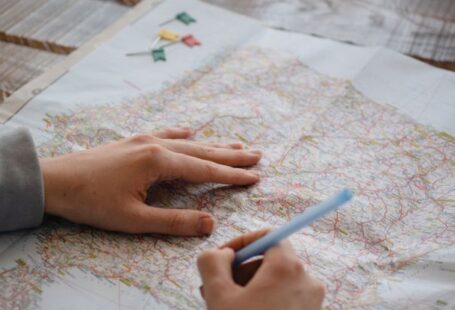
Creating detailed maps requires a combination of art and science. Whether you are mapping out a city, a hiking trail, or a fictional world, the key techniques remain consistent. By mastering these techniques, you can produce maps that are not only aesthetically pleasing but also informative and accurate. In this article, we will explore the essential techniques for creating detailed maps that captivate and inform viewers.
Understanding Scale and Proportion
One of the fundamental aspects of creating detailed maps is understanding scale and proportion. Scale refers to the ratio between a distance on the map and the corresponding distance on the ground. It is crucial to choose an appropriate scale for your map based on the level of detail you want to include and the size of the area you are mapping. Proportion, on the other hand, deals with the relative sizes of different elements on the map. Ensuring that the proportions are accurate will help users interpret the map correctly and navigate with ease.
Choosing the Right Projection
The choice of projection can significantly impact the accuracy and appearance of a map. A map projection is a method used to represent the curved surface of the Earth on a flat surface. Different projections have unique characteristics and are suitable for different purposes. For example, a Mercator projection is often used for navigation because it preserves angles, while a Robinson projection is better for displaying global patterns. Understanding the strengths and weaknesses of various projections will help you choose the right one for your map.
Utilizing Geographic Information Systems (GIS)
Geographic Information Systems (GIS) have revolutionized the way maps are created and analyzed. GIS software allows mapmakers to overlay different layers of information, such as topography, land use, and infrastructure, to create comprehensive and detailed maps. By harnessing the power of GIS, you can incorporate vast amounts of data into your maps, making them more informative and visually engaging.
Employing Color and Symbols Effectively
Color and symbols play a crucial role in conveying information on a map. By using a consistent color scheme and clear symbols, you can help users understand the key features of the map at a glance. It is essential to choose colors that are visually appealing and accessible to all users, including those with color vision deficiencies. Additionally, using symbols that are intuitive and easy to interpret will enhance the usability of the map.
Paying Attention to Detail
Attention to detail is what sets a good map apart from a great one. Small details, such as labeling streets and landmarks, adding a scale bar and north arrow, and including a legend, can make a significant difference in the usability of the map. Ensuring that all elements are clear and legible, even at different zoom levels, will improve the overall user experience and make the map more effective.
Balancing Aesthetics and Functionality
Creating a detailed map is a balancing act between aesthetics and functionality. While it is essential for a map to be visually appealing, it should not sacrifice clarity and usability for the sake of design. Striking the right balance between aesthetics and functionality will result in a map that is not only beautiful to look at but also easy to interpret and navigate.
Incorporating User Feedback
User feedback is a valuable tool for improving the quality of your maps. By seeking input from users, whether through surveys, focus groups, or online reviews, you can identify areas for improvement and make adjustments accordingly. Listening to your audience and incorporating their feedback will help you create maps that meet their needs and preferences.
Ensuring Accuracy and Consistency
Accuracy and consistency are paramount when creating detailed maps. It is essential to double-check all data sources, verify the accuracy of geographic coordinates, and ensure that all elements on the map are aligned correctly. Consistency in labeling, symbology, and scale will make the map easier to read and understand for users.
In conclusion, creating detailed maps requires a combination of technical expertise, artistic skill, and attention to detail. By mastering the key techniques outlined in this article, you can produce maps that are not only visually appealing but also informative and accurate. Whether you are mapping out a city, a hiking trail, or a fictional world, incorporating these techniques will help you create maps that captivate and inform viewers.


