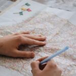
Maps have been an essential tool for navigating the world for centuries, but their significance goes beyond just finding directions. In the realm of education, maps serve as powerful visual aids that can enhance learning in the classroom. From geography to history and even literature, educators can leverage the versatility of maps to engage students, foster critical thinking skills, and promote a deeper understanding of various subjects.
**Stimulating Visual Learning**
One of the primary advantages of using maps in the classroom is their ability to stimulate visual learning. Visual aids have been shown to enhance comprehension and retention of information, making complex concepts more accessible to students. Maps provide a visual representation of geographical features, historical events, and spatial relationships, allowing students to make connections and grasp concepts more effectively than through verbal or written explanations alone. By incorporating maps into lessons, educators can cater to different learning styles and engage students in a more interactive and immersive learning experience.
**Fostering Spatial Awareness**
Maps play a crucial role in fostering spatial awareness among students. By studying maps, students develop a better understanding of the world around them, including the locations of countries, cities, natural landmarks, and historical sites. This spatial awareness not only helps students in their geography lessons but also cultivates a sense of global perspective and cultural awareness. Educators can use maps to teach students about different regions, cultures, and environments, helping them appreciate the diversity and interconnectedness of the world.
**Promoting Critical Thinking Skills**
Incorporating maps into classroom activities can also promote the development of critical thinking skills. When analyzing maps, students are encouraged to interpret information, draw connections, and draw conclusions based on spatial relationships and visual cues. Whether studying historical maps to understand the context of a particular event or using thematic maps to analyze data and trends, students are challenged to think critically and problem solve. Through map-based activities, educators can help students hone their analytical skills and develop a deeper understanding of complex concepts.
**Enhancing Interdisciplinary Learning**
Maps are versatile tools that can be integrated across various subjects to enhance interdisciplinary learning. In addition to geography and history, maps can be used in literature classes to explore the settings of novels or in science classes to study ecosystems and environmental patterns. By incorporating maps into different subjects, educators can create connections between disciplines and provide students with a holistic understanding of the interconnected nature of knowledge. This interdisciplinary approach not only enriches the learning experience but also prepares students to think critically and creatively across different academic domains.
**Encouraging Active Engagement**
Using maps in the classroom encourages active engagement among students. Whether it’s through map-based projects, group activities, or interactive mapping tools, students are actively involved in the learning process and encouraged to collaborate with their peers. By working with maps, students can develop teamwork skills, communication abilities, and problem-solving strategies, all of which are essential for success in the classroom and beyond. Educators can leverage the interactive nature of maps to create dynamic and engaging lessons that spark curiosity and inspire a love for learning.
**Empowering Students Through Spatial Literacy**
In conclusion, maps are powerful tools that can empower students through spatial literacy and critical thinking skills. By incorporating maps into classroom instruction, educators can enhance learning experiences, foster interdisciplinary connections, and promote active engagement among students. From stimulating visual learning to fostering spatial awareness and promoting critical thinking skills, maps offer a multitude of benefits for educators seeking to enrich their lessons and inspire a deeper understanding of the world. By harnessing the potential of maps in the classroom, educators can create an environment that encourages curiosity, exploration, and lifelong learning.


