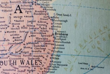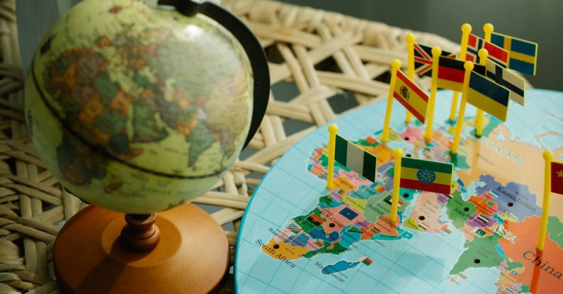
Cartography, the art and science of mapmaking, plays a crucial role in helping us navigate the world around us. A well-crafted map can provide us with valuable information about the environment, resources, and topography of a specific area. However, to truly understand and appreciate the intricacies of cartography, one must first delve into the realm of geographic education. By learning about the fundamental principles of geography, individuals can develop a deeper understanding of how maps are created, interpreted, and utilized. In this article, we will explore the significance of geographic education in enhancing our comprehension of cartography.
The Interconnected Nature of Geography and Cartography
Geography and cartography are intricately connected disciplines that complement each other in various ways. Geography, the study of the Earth’s physical features and human populations, provides the foundational knowledge that underpins cartographic endeavors. Through geographic education, individuals gain insights into concepts such as spatial relationships, scale, and projection—key elements that influence the creation and interpretation of maps.
Understanding the fundamentals of geography enables individuals to appreciate the significance of location, place, and region in cartography. Geographic education fosters spatial awareness, allowing individuals to grasp the spatial patterns and distributions represented on maps. By recognizing the connection between geography and cartography, individuals can better comprehend how maps serve as visual representations of spatial information, facilitating navigation, decision-making, and communication.
The Role of Geographic Education in Enhancing Map Interpretation
One of the primary benefits of geographic education is its role in enhancing map interpretation skills. Maps are powerful tools that convey complex information in a visually accessible format. However, interpreting maps requires more than just a cursory glance—it necessitates a nuanced understanding of geographic concepts and principles. Geographic education equips individuals with the knowledge and skills needed to decipher the layers of information embedded in maps.
Through geographic education, individuals learn to analyze maps critically, considering factors such as scale, symbols, colors, and legends. By understanding the principles of map design and representation, individuals can discern the underlying spatial relationships and patterns depicted on maps. Geographic education also cultivates a spatial perspective, enabling individuals to interpret maps in relation to real-world phenomena and geographic contexts.
The Impact of Geographic Education on Cartographic Literacy
Cartographic literacy, the ability to read and interpret maps effectively, is a crucial skill in today’s information-rich world. Geographic education plays a vital role in fostering cartographic literacy by providing individuals with the knowledge and tools necessary to navigate and comprehend a wide range of maps. By developing a strong foundation in geography, individuals can enhance their cartographic literacy and make informed decisions based on spatial information.
Geographic education empowers individuals to engage with maps critically, recognizing the biases, limitations, and potential distortions that may be present in map representations. Through geographic education, individuals can develop a discerning eye for map quality and accuracy, enabling them to differentiate between reliable and misleading cartographic products. By honing their cartographic literacy skills, individuals can harness the power of maps to explore, analyze, and communicate spatial information effectively.
The Role of Geographic Education in Fostering Spatial Thinking
Spatial thinking, the ability to conceptualize and analyze spatial relationships, is a fundamental skill that underpins both geography and cartography. Geographic education plays a pivotal role in fostering spatial thinking skills by encouraging individuals to view the world through a spatial lens. By engaging with geographic concepts such as location, distance, direction, and scale, individuals can develop a robust spatial cognition that enhances their understanding of maps and spatial phenomena.
Geographic education nurtures spatial thinking by encouraging individuals to explore spatial patterns, connections, and interactions across different scales and contexts. Through hands-on activities, map exercises, and spatial analysis tasks, individuals can enhance their spatial reasoning skills and develop a deeper appreciation for the role of space in shaping human activities and environmental processes. By integrating geographic education into cartographic studies, individuals can cultivate a spatial mindset that enhances their ability to interpret and create maps effectively.
The Importance of Geographic Education in Promoting Geographic Literacy
Geographic literacy, the understanding of geographic concepts and the ability to apply them in real-world contexts, is a cornerstone of geographic education. By promoting geographic literacy, individuals can develop a holistic understanding of the interconnectedness of the Earth’s physical and human systems, as well as the spatial patterns and processes that shape our world. Geographic education fosters geographic literacy by equipping individuals with the knowledge, skills, and attitudes needed to engage with geographic information critically and ethically.
Geographic education enhances geographic literacy by providing individuals with a solid foundation in key geographic concepts such as place, space, environment, and region. By immersing individuals in the study of geographic phenomena and processes, geographic education instills in them a deep appreciation for the complexities of the Earth’s natural and human environments. Through geographic literacy, individuals can make informed decisions, solve real-world problems, and contribute to sustainable development efforts that promote environmental stewardship and social equity.
In Conclusion: The Transformative Power of Geographic Education in Cartography
Geographic education serves as a gateway to understanding the intricate world of cartography. By delving into the principles of geography, individuals can enhance their map interpretation skills, foster cartographic literacy, develop spatial thinking abilities, and promote geographic literacy. Through geographic education, individuals can unlock the transformative power of maps as tools for exploration, analysis, communication, and decision-making. By recognizing the interconnected nature of geography and cartography, individuals can navigate the complexities of our spatially diverse world with confidence and clarity. Geographic education is not just a means to an end—it is a journey of discovery that enriches our understanding of the Earth and the maps that represent it.